When I found this, I was fascinated. Although my memory is somewhat vague on the exact time, it must have been when I was in the fifth grade, after I had read J.R.R. Tolkien's Lord of the Rings and Richard Adams' Watership Down. Both of these works of fiction contained maps and detailed descriptions of the geography in which the story took place -- indeed, in both works the geography was in some way crucial to the development of the story itself. I had already grasped the importance of maps. Now I had the key in my hands!
From that time on, I have constantly been creating maps and geographies, sometimes on paper, sometimes only in my mind. Many an hour in my younger days was spent dreaming up some imaginary town, city, or patch of countryside, and drawing the layout of its roads, buildings, hills, woods, rivers and lakes. Tolkien taught me that I needn't stop at the local scale, and so I expanded my horizons to nations and continents. At about the same time, I had discovered science fiction, and so naturally the next step was to create worlds and solar systems. After reading Larry Niven's Ringworld in seventh grade, I acquired a package of long, narrow folded paper from the father of a friend of mine, who worked as a court stenographer, and began to map a ringworld of my own. Of course I knew I would never finish it, but the idea of an endless map was in itself an irresistible lure to me.
It was rarely enough for me to merely create maps, though. Part of my fascination for maps in the first place came from looking at the maps in reference books and wondering why they looked the way they did. Why are cities located where they are? What makes one stretch of coastline smooth and another convoluted? Why are the borders of countries in certain places, and why have they changed over the years? This, in turn, led my curiosity to investigate many other branches of knowledge: history, geology, ecology and economics primarily, and the narrower fields within them which might provide insight into the rhyme and reason behind a map. I tried in turn to incorporate what I had learned into my own maps, and many of them were made to illustrate or play with a particular principle which I had learned. It still remains a dream of mine to create a set of maps, and accompanying history and geography, of a world as rich and varied as our own, and with as much purpose behind each individual element.
My passion for creating maps may never find any practical application, but it has inspired many intellectual excursions which served to broaden my knowledge. A great deal of my nonfiction reading can be traced, directly or indirectly, back to curiosity over some feature on a map. For a while it came in handy while designing campaigns for role playing games, but often I would get so caught up in the creation of the world that I never got around to the material that would actually be used in the game.
So do I still create maps today? Certainly. Most of them never find their way to paper, but that in no way lessens their reality. There are always new worlds to be discovered, explored and mapped. I delight in being a pioneer on the frontiers of the mind.
Click here to return to the Index of Digressions.
Click here to return to the Index of Writings.
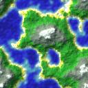
Thanks to Peter Gruhn for the nifty graphic.